Geolocate

Kaman topographic map

Click on the map to display elevation.

About this map

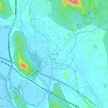
Name: Kaman topographic map, elevation, terrain.

Location: Kaman, Vasai-Virar, Vasai, Palghar, Maharashtra, 401301, India (19.33585 72.89047 19.37585 72.93047)

Average elevation: 59 ft

Minimum elevation: -3 ft

Maximum elevation: 531 ft

Gear up for your next adventure:

🧤Hiking Gloves - Protective gloves for rugged trails
🏔️Mountain Trail Maps - High‑detail maps for popular peaks
🚗GPS Dash Cams - Record your scenic drives through mountain passes and canyons
🕶️Glacier Sunglasses - Side shields to protect eyes from high-altitude snow glare
🔪Outdoor Multitools - Essential survival tools for gear repair and field use

As an Amazon Associate, this site earns from qualifying purchases at no extra cost to you.