
Thank you for supporting this site ❤️
Make a donation
Make a donation
Gear up for your next adventure:
As an Amazon Associate, this site earns from qualifying purchases at no extra cost to you.
Carriazo topographic map
Click on the map to display elevation.
Thank you for supporting this site ❤️
Make a donation
Make a donation
Gear up for your next adventure:
As an Amazon Associate, this site earns from qualifying purchases at no extra cost to you.
About this map
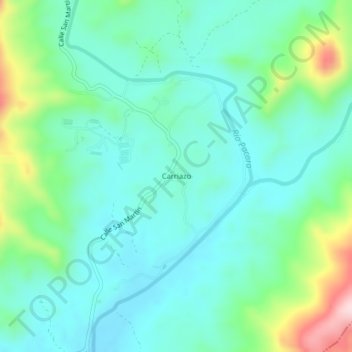
Name: Carriazo topographic map, elevation, terrain.
Location: Carriazo, San Martín, Distrito Panamá, Panamá (9.18529 -79.26232 9.22529 -79.22232)
Average elevation: 449 ft
Minimum elevation: 210 ft
Maximum elevation: 1,214 ft
Thank you for supporting this site ❤️
Make a donation
Make a donation
Gear up for your next adventure:
As an Amazon Associate, this site earns from qualifying purchases at no extra cost to you.