
Thank you for supporting this site ❤️
Make a donation
Make a donation
Gear up for your next adventure:
As an Amazon Associate, this site earns from qualifying purchases at no extra cost to you.
Degloor topographic map
Click on the map to display elevation.
Thank you for supporting this site ❤️
Make a donation
Make a donation
Gear up for your next adventure:
As an Amazon Associate, this site earns from qualifying purchases at no extra cost to you.
About this map
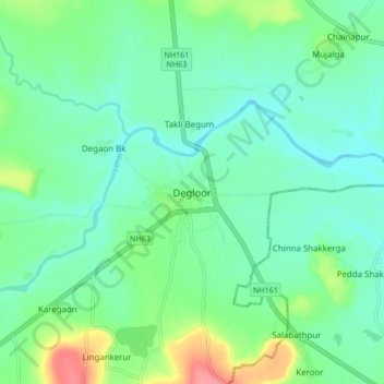
Name: Degloor topographic map, elevation, terrain.
Location: Degloor, Deglur, Nanded District, Maharashtra, 431717, India (18.50966 77.53909 18.58966 77.61909)
Average elevation: 1,227 ft
Minimum elevation: 1,161 ft
Maximum elevation: 1,414 ft
Thank you for supporting this site ❤️
Make a donation
Make a donation
Gear up for your next adventure:
As an Amazon Associate, this site earns from qualifying purchases at no extra cost to you.