
Thank you for supporting this site ❤️
Make a donation
Make a donation
Gear up for your next adventure:
As an Amazon Associate, this site earns from qualifying purchases at no extra cost to you.
Jonquera topographic map
Click on the map to display elevation.
Thank you for supporting this site ❤️
Make a donation
Make a donation
Gear up for your next adventure:
As an Amazon Associate, this site earns from qualifying purchases at no extra cost to you.
About this map
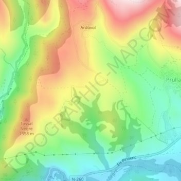
Name: Jonquera topographic map, elevation, terrain.
Location: Jonquera, Prullans, Cerdagne, Catalogne, 25727, Espagne (42.36870 1.70913 42.38870 1.72913)
Average elevation: 3,901 ft
Minimum elevation: 3,205 ft
Maximum elevation: 4,823 ft
Thank you for supporting this site ❤️
Make a donation
Make a donation
Gear up for your next adventure:
As an Amazon Associate, this site earns from qualifying purchases at no extra cost to you.