
Thank you for supporting this site ❤️
Make a donation
Make a donation
Gear up for your next adventure:
As an Amazon Associate, this site earns from qualifying purchases at no extra cost to you.
Lainbach topographic map
Click on the map to display elevation.
Thank you for supporting this site ❤️
Make a donation
Make a donation
Gear up for your next adventure:
As an Amazon Associate, this site earns from qualifying purchases at no extra cost to you.
About this map
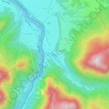
Name: Lainbach topographic map, elevation, terrain.
Location: Lainbach, Landl, Bezirk Liezen, Styrie, 8931, Autriche (47.61604 14.74678 47.65604 14.78678)
Average elevation: 2,362 ft
Minimum elevation: 1,503 ft
Maximum elevation: 4,216 ft
Thank you for supporting this site ❤️
Make a donation
Make a donation
Gear up for your next adventure:
As an Amazon Associate, this site earns from qualifying purchases at no extra cost to you.