
Make a donation
Gear up for your next adventure:
As an Amazon Associate, this site earns from qualifying purchases at no extra cost to you.
Wüstenhof topographic map
Click on the map to display elevation.
Make a donation
Gear up for your next adventure:
As an Amazon Associate, this site earns from qualifying purchases at no extra cost to you.
Wüstenhof
1548 wird der Ort erstmals unter der Bezeichnung „Woestenhoeve“ in den Listen der bergischen Spann- und Schüppendienste genannt. Die Karte Topographia Ducatus Montani aus dem Jahre 1715 zeigt die Ortschaft mit der Ortsbezeichnung „Wüsthof“ und zwei Höfen. Die Topographische Aufnahme der Rheinlande von 1824 benennt den Ort mit „Wüstehof“. Die Karte verzeichnet auf umgrenztem Hofraum zwei getrennt voneinander liegende Grundrisse. Ab der Preußischen Uraufnahme von 1844 wird die Ortsbezeichnung Wüstenhof verwendet.
Make a donation
Gear up for your next adventure:
As an Amazon Associate, this site earns from qualifying purchases at no extra cost to you.
About this map
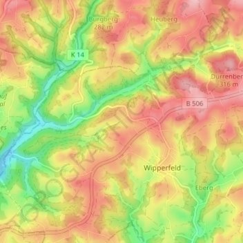
Name: Wüstenhof topographic map, elevation, terrain.
Average elevation: 873 ft
Minimum elevation: 604 ft
Maximum elevation: 1,089 ft
Make a donation
Gear up for your next adventure:
As an Amazon Associate, this site earns from qualifying purchases at no extra cost to you.