Geolocate

Springfield topographic map

Click on the map to display elevation.

About this map

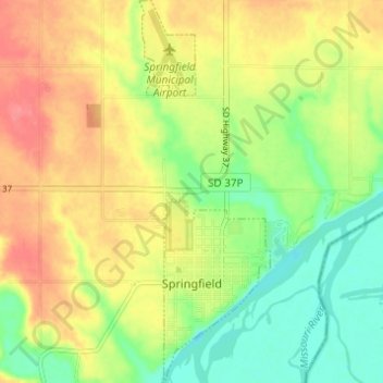
Name: Springfield topographic map, elevation, terrain.

Location: Springfield, Bon Homme County, South Dakota, United States (42.84241 -97.90575 42.88731 -97.88451)

Average elevation: 1,293 ft

Minimum elevation: 1,184 ft

Maximum elevation: 1,404 ft

Bon Homme County trails, hiking, mountain biking, running and outdoor activities

Gear up for your next adventure:

🌡️Portable Weather Meter - Track weather conditions on the trail
🔦Compact Flashlight - Reliable flashlight for emergencies
🚁Photography Drones - Capture stunning aerial views of landforms and topography
🪶Camp Gear Gift Set - Perfect gift bundle for outdoor fans
🔌USB Car Charger - Car charger for on‑the‑go power needs

As an Amazon Associate, this site earns from qualifying purchases at no extra cost to you.