Geolocate

College Corner topographic map

Click on the map to display elevation.

About this map

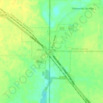
Name: College Corner topographic map, elevation, terrain.

Location: College Corner, Oxford Township, Butler County, Ohio, United States (39.56042 -84.81514 39.57485 -84.80481)

Average elevation: 997 ft

Minimum elevation: 958 ft

Maximum elevation: 1,024 ft

Butler County trails, hiking, mountain biking, running and outdoor activities

Other topographic maps

Click on a map to view its topography, its elevation and its terrain.

Williamsdale

United States > Ohio > Butler County

Average elevation: 633 ft

Woodsdale

United States > Ohio > Butler County

Average elevation: 669 ft

Okeana

United States > Ohio > Butler County

Average elevation: 741 ft

West Chester

United States > Ohio > Butler County > West Chester

Average elevation: 758 ft

Darrtown

United States > Ohio > Butler County

Average elevation: 781 ft

Wieche Field

United States > Ohio > Butler County > Seven Mile

Average elevation: 682 ft

Mayfield

United States > Ohio > Butler County > Middletown

Average elevation: 696 ft

Crawford Woods

United States > Ohio > Butler County > Hamilton

Average elevation: 673 ft

Astoria

United States > Ohio > Butler County

Average elevation: 863 ft

Macedonia

United States > Ohio > Butler County

Average elevation: 810 ft

Bethany

United States > Ohio > Butler County

Average elevation: 850 ft

Peffer Park

United States > Ohio > Butler County > Oxford

Average elevation: 869 ft

Gear up for your next adventure:

🦟Ultrasonic Repellers - Create a bug-free zone at your camp or rest stop
🏔️Mountain Trail Maps - High‑detail maps for popular peaks
🔌USB Car Charger - Car charger for on‑the‑go power needs
🥾Men's Hiking Boots - Durable, waterproof footwear for rugged terrain and steep inclines
🕶️Glacier Sunglasses - Side shields to protect eyes from high-altitude snow glare

As an Amazon Associate, this site earns from qualifying purchases at no extra cost to you.