Lynn topographic map
Interactive map
Click on the map to display elevation.
About this map
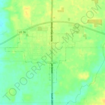
Name: Lynn topographic map, elevation, terrain.
Location: Lynn, Randolph County, Indiana, United States (40.03954 -84.95567 40.05503 -84.93216)
Average elevation: 1,168 ft
Minimum elevation: 1,125 ft
Maximum elevation: 1,204 ft
Other topographic maps
Click on a map to view its topography, its elevation and its terrain.
Union City
United States > Indiana > Randolph County
Union City, Randolph County, Indiana, United States
Average elevation: 1,093 ft
Parker City
United States > Indiana > Randolph County
Parker City, Randolph County, Indiana, 47368, United States
Average elevation: 1,024 ft
Windsor
United States > Indiana > Randolph County
Windsor, Randolph County, Indiana, 47368, United States
Average elevation: 1,024 ft
Farmland
United States > Indiana > Randolph County
Farmland, Randolph County, Indiana, United States
Average elevation: 1,043 ft
Modoc
United States > Indiana > Randolph County
Modoc, Randolph County, Indiana, United States
Average elevation: 1,165 ft
Winchester
United States > Indiana > Randolph County
Winchester, Randolph County, Indiana, 47494, United States
Average elevation: 1,099 ft