Geolocate

Ilasan Ibaba topographic map

Click on the map to display elevation.

About this map

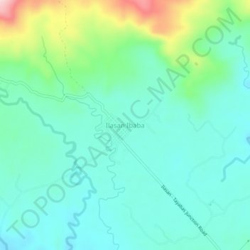
Name: Ilasan Ibaba topographic map, elevation, terrain.

Location: Ilasan Ibaba, Tayabas, Quezon, Calabarzon, 4327, Philippines (14.04351 121.61433 14.08351 121.65433)

Average elevation: 702 ft

Minimum elevation: 502 ft

Maximum elevation: 1,342 ft

Gear up for your next adventure:

🧴Hand Sanitizer - Keep hands clean while hiking
🎁Geography Themed Gifts - Unique gift ideas for map lovers and geography enthusiasts
🎒Waterproof Dry Bags - Keep your electronics and maps dry inside your pack
🧭Orienteering Set - Complete compass and map reading kit
Backpacking Tent - Lightweight and durable tent for multi‑day hikes

As an Amazon Associate, this site earns from qualifying purchases at no extra cost to you.