
Thank you for supporting this site ❤️
Make a donation
Make a donation
Gear up for your next adventure:
As an Amazon Associate, this site earns from qualifying purchases at no extra cost to you.
Kaba topographic map
Click on the map to display elevation.
Thank you for supporting this site ❤️
Make a donation
Make a donation
Gear up for your next adventure:
As an Amazon Associate, this site earns from qualifying purchases at no extra cost to you.
About this map
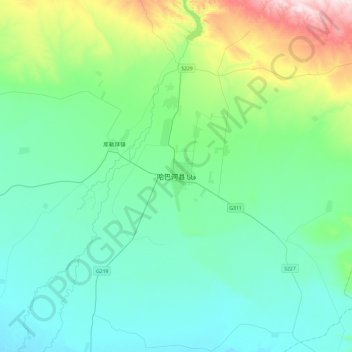
Name: Kaba topographic map, elevation, terrain.
Location: Kaba, 阿克齐镇, Habahe County, Altay Prefecture, Xinjiang, China (47.89950 86.24992 48.21950 86.56992)
Average elevation: 1,827 ft
Minimum elevation: 1,460 ft
Maximum elevation: 3,392 ft
Thank you for supporting this site ❤️
Make a donation
Make a donation
Gear up for your next adventure:
As an Amazon Associate, this site earns from qualifying purchases at no extra cost to you.