
Thank you for supporting this site ❤️
Make a donation
Make a donation
Gear up for your next adventure:
As an Amazon Associate, this site earns from qualifying purchases at no extra cost to you.
Lomba topographic map
Click on the map to display elevation.
Thank you for supporting this site ❤️
Make a donation
Make a donation
Gear up for your next adventure:
As an Amazon Associate, this site earns from qualifying purchases at no extra cost to you.
About this map
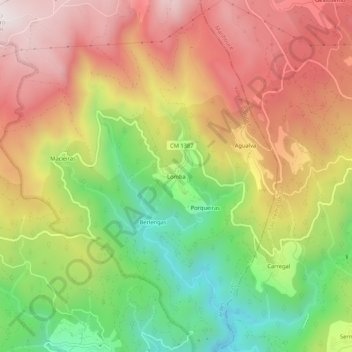
Name: Lomba topographic map, elevation, terrain.
Location: Lomba, Arões, Vale de Cambra, Aveiro, 3730-018, Portugal (40.80584 -8.27198 40.84584 -8.23198)
Average elevation: 2,041 ft
Minimum elevation: 554 ft
Maximum elevation: 3,425 ft
Thank you for supporting this site ❤️
Make a donation
Make a donation
Gear up for your next adventure:
As an Amazon Associate, this site earns from qualifying purchases at no extra cost to you.