
Thank you for supporting this site ❤️
Make a donation
Make a donation
Gear up for your next adventure:
As an Amazon Associate, this site earns from qualifying purchases at no extra cost to you.
San Francisco topographic map
Click on the map to display elevation.
Thank you for supporting this site ❤️
Make a donation
Make a donation
Gear up for your next adventure:
As an Amazon Associate, this site earns from qualifying purchases at no extra cost to you.
About this map
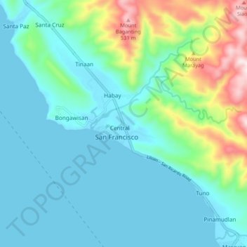
Name: San Francisco topographic map, elevation, terrain.
Location: San Francisco, Southern Leyte, Eastern Visayas, Philippines (10.01631 125.11810 10.09631 125.19810)
Average elevation: 315 ft
Minimum elevation: 0 ft
Maximum elevation: 1,886 ft
Thank you for supporting this site ❤️
Make a donation
Make a donation
Gear up for your next adventure:
As an Amazon Associate, this site earns from qualifying purchases at no extra cost to you.