
Thank you for supporting this site ❤️
Make a donation
Make a donation
Gear up for your next adventure:
As an Amazon Associate, this site earns from qualifying purchases at no extra cost to you.
Seaton Burn topographic map
Click on the map to display elevation.
Thank you for supporting this site ❤️
Make a donation
Make a donation
Gear up for your next adventure:
As an Amazon Associate, this site earns from qualifying purchases at no extra cost to you.
About this map
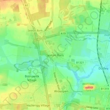
Name: Seaton Burn topographic map, elevation, terrain.
Average elevation: 213 ft
Minimum elevation: 161 ft
Maximum elevation: 276 ft
Thank you for supporting this site ❤️
Make a donation
Make a donation
Gear up for your next adventure:
As an Amazon Associate, this site earns from qualifying purchases at no extra cost to you.
Other topographic maps
Click on a map to view its topography, its elevation and its terrain.
Northumberland Square
United Kingdom > England > North Tyneside > North Shields
Average elevation: 95 ft
Rising Sun Country Park
United Kingdom > England > North Tyneside > Holystone
Average elevation: 190 ft