
Thank you for supporting this site ❤️
Make a donation
Make a donation
Gear up for your next adventure:
As an Amazon Associate, this site earns from qualifying purchases at no extra cost to you.
Manokwari topographic map
Click on the map to display elevation.
Thank you for supporting this site ❤️
Make a donation
Make a donation
Gear up for your next adventure:
As an Amazon Associate, this site earns from qualifying purchases at no extra cost to you.
About this map
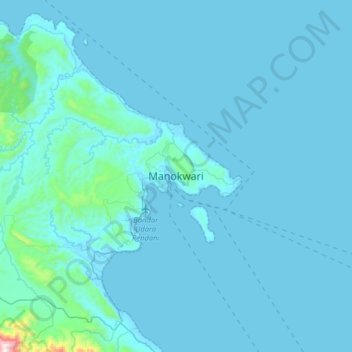
Name: Manokwari topographic map, elevation, terrain.
Location: Manokwari, West Papua, Western New Guinea, 98312, Indonesia (-1.02145 133.91673 -0.70145 134.23673)
Average elevation: 161 ft
Minimum elevation: -7 ft
Maximum elevation: 3,944 ft
Thank you for supporting this site ❤️
Make a donation
Make a donation
Gear up for your next adventure:
As an Amazon Associate, this site earns from qualifying purchases at no extra cost to you.