Geolocate

Pinjore topographic map

Click on the map to display elevation.

About this map
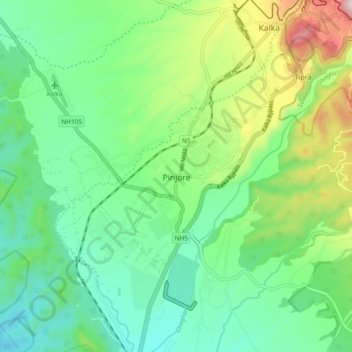
Name: Pinjore topographic map, elevation, terrain.

Location: Pinjore, Kalka, Panchkula, Haryana, 134102, India (30.76424 76.87495 30.84424 76.95495)

Average elevation: 1,818 ft

Minimum elevation: 1,302 ft

Maximum elevation: 3,051 ft

Gear up for your next adventure:

🏔️Mountain Trail Maps - High‑detail maps for popular peaks
🧣Merino Neck Gaiters - Multi-functional headwear for wind and sun protection
📷Action Cameras - Rugged cameras to document your journeys across rugged terrain
🩹Survival Bandages - High‑quality bandages for emergencies
🧺Microfiber Travel Towels - Compact and fast-drying towels for trail use

As an Amazon Associate, this site earns from qualifying purchases at no extra cost to you.