Geolocate

Peretti topographic map

Click on the map to display elevation.

About this map

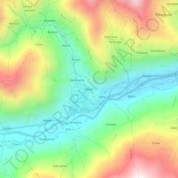
Name: Peretti topographic map, elevation, terrain.

Location: Peretti, Sparone, Torino, Piemonte, Italia (45.39673 7.52707 45.43673 7.56707)

Average elevation: 2,936 ft

Minimum elevation: 1,532 ft

Maximum elevation: 5,157 ft

Gear up for your next adventure:

🧺Microfiber Travel Towels - Compact and fast-drying towels for trail use
🪶Trail Camera - Capture wildlife on your hikes
🪑Portable Camp Table - Compact table for campsite meals
🥾Women's Hiking Boots - Top-rated trail boots with ankle support and superior grip
🧤Tactile Hiking Gloves - Keep hands warm while operating GPS and smartphone screens

As an Amazon Associate, this site earns from qualifying purchases at no extra cost to you.