
Thank you for supporting this site ❤️
Make a donation
Make a donation
Gear up for your next adventure:
As an Amazon Associate, this site earns from qualifying purchases at no extra cost to you.
Letsatseng topographic map
Click on the map to display elevation.
Thank you for supporting this site ❤️
Make a donation
Make a donation
Gear up for your next adventure:
As an Amazon Associate, this site earns from qualifying purchases at no extra cost to you.
About this map
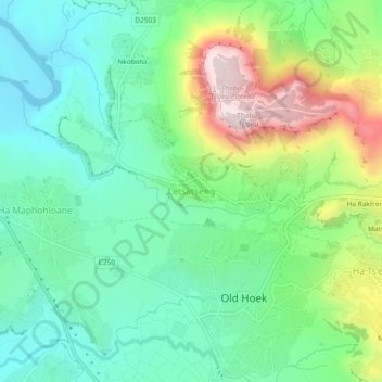
Name: Letsatseng topographic map, elevation, terrain.
Location: Letsatseng, Mohale's Hoek District, Lesotho (-30.11534 27.44755 -30.07534 27.48755)
Average elevation: 5,128 ft
Minimum elevation: 4,678 ft
Maximum elevation: 6,099 ft
Thank you for supporting this site ❤️
Make a donation
Make a donation
Gear up for your next adventure:
As an Amazon Associate, this site earns from qualifying purchases at no extra cost to you.