
Thank you for supporting this site ❤️
Make a donation
Make a donation
Gear up for your next adventure:
As an Amazon Associate, this site earns from qualifying purchases at no extra cost to you.
Filippazzi topographic map
Click on the map to display elevation.
Thank you for supporting this site ❤️
Make a donation
Make a donation
Gear up for your next adventure:
As an Amazon Associate, this site earns from qualifying purchases at no extra cost to you.
About this map
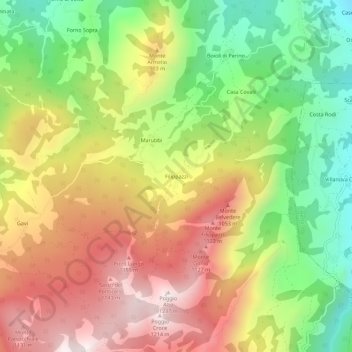
Name: Filippazzi topographic map, elevation, terrain.
Location: Filippazzi, Coli, Piacenza, Emilia-Romagna, Italia (44.76105 9.45863 44.80105 9.49863)
Average elevation: 2,507 ft
Minimum elevation: 1,099 ft
Maximum elevation: 3,973 ft
Thank you for supporting this site ❤️
Make a donation
Make a donation
Gear up for your next adventure:
As an Amazon Associate, this site earns from qualifying purchases at no extra cost to you.