Geolocate

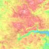
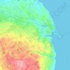
Padborg topographic map

Click on the map to display elevation.

About this map

Name: Padborg topographic map, elevation, terrain.

Location: Padborg, Aabenraa Municipality, Region of Southern Denmark, 6330, Denmark (54.80950 9.34065 54.84950 9.38065)

Average elevation: 131 ft

Minimum elevation: 13 ft

Maximum elevation: 190 ft

Other topographic maps

Click on a map to view its topography, its elevation and its terrain.
Funen

Denmark > Region of Southern Denmark

Average elevation: 62 ft

Funen

Denmark > Region of Southern Denmark

Average elevation: 62 ft

Funen

Denmark > Region of Southern Denmark

Average elevation: 62 ft

Fanø

Denmark > Region of Southern Denmark > Sønderho

Average elevation: 3 ft

Rømø

Denmark > Region of Southern Denmark

Average elevation: 0 ft

Funen

Denmark > Region of Southern Denmark

Average elevation: 62 ft

Skarø

Denmark > Region of Southern Denmark

Average elevation: 0 ft

Guldbjerg

Denmark > Region of Southern Denmark

Average elevation: 75 ft

Egholm

Denmark > Region of Southern Denmark

Average elevation: 0 ft

Funen

Denmark > Region of Southern Denmark

Average elevation: 62 ft

Ærø

Denmark > Region of Southern Denmark

Average elevation: 10 ft

Funen

Denmark > Region of Southern Denmark

Average elevation: 62 ft

Gear up for your next adventure:

📻Weather Alert Radios - Stay informed of storm risks while off-the-grid
🧥Waterproof Jacket for Hiking - Breathable and rugged rain jacket for outdoor excursions
🍳Camping Cook Set - Complete cookware for outdoor meals
🪶Thermal Camp Blanket - Extra warmth for cold nights
🧦Merino Wool Socks - Moisture-wicking, blister-preventing socks for long treks

As an Amazon Associate, this site earns from qualifying purchases at no extra cost to you.