Geolocate

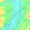
Chalandray topographic map

Click on the map to display elevation.

About this map

Name: Chalandray topographic map, elevation, terrain.

Location: Chalandray, Poitiers, Vienne, Nouvelle-Aquitaine, Metropolitan France, 86190, France (46.62272 -0.06788 46.68060 0.05374)

Average elevation: 515 ft

Minimum elevation: 407 ft

Maximum elevation: 581 ft

Other topographic maps

Click on a map to view its topography, its elevation and its terrain.
La Chasseigne

France > Nouvelle-Aquitaine > Vienne > Thollet

Average elevation: 528 ft

Montin

France > Nouvelle-Aquitaine > Vienne > Vicq-sur-Gartempe

Average elevation: 325 ft

Les Bordes

France > Nouvelle-Aquitaine > Vienne > Gouex

Average elevation: 354 ft

Verrières

France > Nouvelle-Aquitaine > Vienne > Champniers

Average elevation: 449 ft

Gear up for your next adventure:

🪶Paracord Bracelet - Survival bracelet with built‑in tools
🌎3D Topographic Globes - Raised relief globes for a tactile understanding of geography
🩹Survival Bandages - High‑quality bandages for emergencies
🪓Survival Multi‑Tool - Versatile tool for camp and trail tasks
👟Men's Trail Runners - Lightweight footwear for fast-paced exploration and light hiking

As an Amazon Associate, this site earns from qualifying purchases at no extra cost to you.