
Thank you for supporting this site ❤️
Make a donation
Make a donation
Gear up for your next adventure:
As an Amazon Associate, this site earns from qualifying purchases at no extra cost to you.
Diustes topographic map
Click on the map to display elevation.
Thank you for supporting this site ❤️
Make a donation
Make a donation
Gear up for your next adventure:
As an Amazon Associate, this site earns from qualifying purchases at no extra cost to you.
About this map
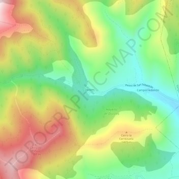
Name: Diustes topographic map, elevation, terrain.
Location: Diustes, Villar del Río, Soria, Castilla y León, España (42.08467 -2.43431 42.12467 -2.39431)
Average elevation: 4,403 ft
Minimum elevation: 3,599 ft
Maximum elevation: 5,453 ft
Thank you for supporting this site ❤️
Make a donation
Make a donation
Gear up for your next adventure:
As an Amazon Associate, this site earns from qualifying purchases at no extra cost to you.