
Thank you for supporting this site ❤️
Make a donation
Make a donation
Gear up for your next adventure:
As an Amazon Associate, this site earns from qualifying purchases at no extra cost to you.
Chancayllo topographic map
Click on the map to display elevation.
Thank you for supporting this site ❤️
Make a donation
Make a donation
Gear up for your next adventure:
As an Amazon Associate, this site earns from qualifying purchases at no extra cost to you.
About this map
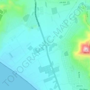
Name: Chancayllo topographic map, elevation, terrain.
Location: Chancayllo, Chancay, Huaral, Lima, Perú (-11.50979 -77.32485 -11.46979 -77.28485)
Average elevation: 230 ft
Minimum elevation: -3 ft
Maximum elevation: 1,480 ft
Thank you for supporting this site ❤️
Make a donation
Make a donation
Gear up for your next adventure:
As an Amazon Associate, this site earns from qualifying purchases at no extra cost to you.