Geolocate

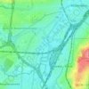
Anderlecht topographic map

Click on the map to display elevation.

About this map

Name: Anderlecht topographic map, elevation, terrain.

Location: Anderlecht, Brussels-Capital, 1070, Belgium (50.80706 4.24377 50.85032 4.34011)

Average elevation: 141 ft

Minimum elevation: 52 ft

Maximum elevation: 351 ft

Other topographic maps

Click on a map to view its topography, its elevation and its terrain.
Aa

Belgium > Brussels-Capital > Anderlecht

Average elevation: 115 ft

Aa

Belgium > Brussels-Capital > Anderlecht

Average elevation: 115 ft

Gear up for your next adventure:

👖Convertible Hiking Pants - Versatile zip-off pants for changing altitudes and temperatures
🛰️Handheld GPS Units - Professional satellite navigators for precise backcountry mapping
☀️Outdoor Sunscreen - High protection sunscreen for outdoor activities
🌎3D Topographic Globes - Raised relief globes for a tactile understanding of geography
🧭Map Reading Tools - Tools and kits for map navigation

As an Amazon Associate, this site earns from qualifying purchases at no extra cost to you.