Geolocate

Sonsbeck topographic map

Click on the map to display elevation.

About this map

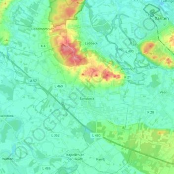
Name: Sonsbeck topographic map, elevation, terrain.

Location: Sonsbeck, Kreis Wesel, North Rhine-Westphalia, 47665, Germany (51.56029 6.29199 51.67328 6.44340)

Average elevation: 102 ft

Minimum elevation: 46 ft

Maximum elevation: 302 ft

Other topographic maps

Click on a map to view its topography, its elevation and its terrain.

Labbeck

Germany > North Rhine-Westphalia > Kreis Wesel

Average elevation: 141 ft

Gear up for your next adventure:

🔥Fast-Boil Camping Stoves - Efficient cooking systems for quick trail meals
💧Water Filtration Bottles - Safely drink from streams and lakes while exploring
🗺️NatGeo Topo Maps - High-quality waterproof printed topographic maps of US Parks
☀️Outdoor Sunscreen - High protection sunscreen for outdoor activities
🧣Merino Neck Gaiters - Multi-functional headwear for wind and sun protection

As an Amazon Associate, this site earns from qualifying purchases at no extra cost to you.