Geolocate

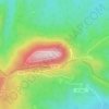
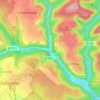
Obernai topographic map

Click on the map to display elevation.

About this map
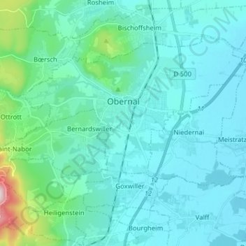
Name: Obernai topographic map, elevation, terrain.

Location: Obernai, Sélestat-Erstein, Bas-Rhin, European Collectivity of Alsace, Grand Est, Metropolitan France, 67210, France (48.42429 7.41785 48.48512 7.54567)

Average elevation: 722 ft

Minimum elevation: 495 ft

Maximum elevation: 2,339 ft

Other topographic maps

Click on a map to view its topography, its elevation and its terrain.

le Champ du Feu

France > Grand Est > Bas-Rhin > Belmont

Average elevation: 3,100 ft

Erstein-Gare

France > Grand Est > Bas-Rhin > Erstein

Average elevation: 505 ft

Col du Donon

France > Grand Est > Bas-Rhin > Grandfontaine

Average elevation: 2,277 ft

2te Gewann Neufeld

France > Grand Est > Bas-Rhin > Offendorf

Average elevation: 417 ft

Graufthal

France > Grand Est > Bas-Rhin > Eschbourg

Average elevation: 951 ft

Willigen

France > Grand Est > Bas-Rhin > Kilstett

Average elevation: 427 ft

Grande Île

France > Grand Est > Bas-Rhin > Strasbourg

Average elevation: 476 ft

Roed

France > Grand Est > Bas-Rhin > Wingersheim les Quatre Bans > Gingsheim

Average elevation: 748 ft

Le Hang

France > Grand Est > Bas-Rhin > Bourg-Bruche

Average elevation: 1,903 ft

Su

France > Grand Est > Bas-Rhin > Soultz-les-Bains

Average elevation: 679 ft

Tête Pelée

France > Grand Est > Bas-Rhin > La Broque

Average elevation: 2,205 ft

Kreutzel

France > Grand Est > Bas-Rhin > Baerendorf

Average elevation: 902 ft

Gear up for your next adventure:

🧯Portable Fire Pit - Compact fire pit for camping spots
🌡️Handheld Weather Meters - Measure wind, temp, and pressure for safe mountain travel
🧴Hand Sanitizer - Keep hands clean while hiking
🔭Telescopic Hiking Pole - Adjustable pole for hiking stability
🔦Powerful Headlamps - Ultra-bright hands-free lighting for night navigation

As an Amazon Associate, this site earns from qualifying purchases at no extra cost to you.