
Streator topographic map
Click on the map to display elevation.
Streator
Streator lies within the Vermilion River/Illinois River Basin Assessment Area (VRAA) defined by the watershed of the Vermilion River, a major tributary to the Illinois River in Central Illinois, an area of mostly flat prairie. The topography of the basin is a complex collection of buried valleys, lowlands and uplands carved by repeated episodes of continental glaciation.
About this map
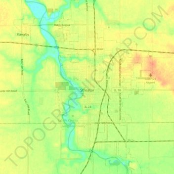
Name: Streator topographic map, elevation, terrain.
Location: Streator, LaSalle County, Illinois, 61364, United States (41.08354 -88.85512 41.16096 -88.79690)
Average elevation: 627 ft
Minimum elevation: 554 ft
Maximum elevation: 679 ft
LaSalle County trails, hiking, mountain biking, running and outdoor activities
Other topographic maps
Click on a map to view its topography, its elevation and its terrain.
Lower Fox River - Blakes Landing Nature Preserve
United States > Illinois > LaSalle County > Blakes
Average elevation: 597 ft