Geolocate

Newhalen topographic map

Click on the map to display elevation.

About this map

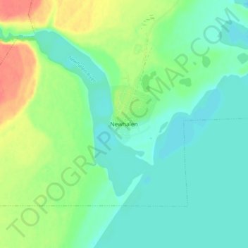
Name: Newhalen topographic map, elevation, terrain.

Location: Newhalen, Lake and Peninsula, Alaska, 99606, United States (59.70000 -154.91722 59.74000 -154.87722)

Average elevation: 75 ft

Minimum elevation: 26 ft

Maximum elevation: 184 ft

Lake and Peninsula trails, hiking, mountain biking, running and outdoor activities

Gear up for your next adventure:

🪵Folding Camp Saw - Compact saw for wood and campsite work
🥘Titanium Cookware - Durable, featherlight pots and pans for backpacking
🏫Relief Map Kits - Hands-on tools for teaching landforms and elevation
🧷Carabiner Set - Durable clips for gear attachment
🧣Hiking Neck Gaiter - Multi‑use neck protection for outdoor weather

As an Amazon Associate, this site earns from qualifying purchases at no extra cost to you.