Geolocate

Winslow topographic map

Click on the map to display elevation.

About this map

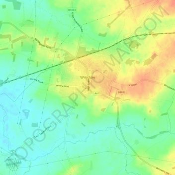
Name: Winslow topographic map, elevation, terrain.

Location: Winslow, Buckinghamshire, England, United Kingdom (51.92679 -0.91392 51.95768 -0.85425)

Average elevation: 338 ft

Minimum elevation: 272 ft

Maximum elevation: 420 ft

Other topographic maps

Click on a map to view its topography, its elevation and its terrain.

Bledlow

United Kingdom > England > Buckinghamshire

Average elevation: 387 ft

Gear up for your next adventure:

🎁Geography Themed Gifts - Unique gift ideas for map lovers and geography enthusiasts
🪑Portable Camp Table - Compact table for campsite meals
🧭Compass with Lanyard - Easy‑carry compass for navigation
🦶Hiking Gaiters - Keep debris and water out of your boots
🔊Portable Camp Speaker - Music and alerts at camp

As an Amazon Associate, this site earns from qualifying purchases at no extra cost to you.