Geolocate

Hawara topographic map

Click on the map to display elevation.

About this map

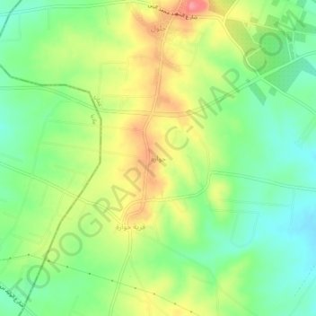
Name: Hawara topographic map, elevation, terrain.

Location: Hawara, Jizah Sub-District, Jizah District, Amman, Jordan (31.68000 35.83000 31.72000 35.87000)

Average elevation: 2,523 ft

Minimum elevation: 2,402 ft

Maximum elevation: 2,687 ft

Gear up for your next adventure:

🕶️Glacier Sunglasses - Side shields to protect eyes from high-altitude snow glare
🖼️Topo Map Wall Art - Decorative topographic prints of famous peaks and regions
🧭Hiking Compass - Precision compass for reliable navigation in the wilderness
🌎3D Topographic Globes - Raised relief globes for a tactile understanding of geography
🥾Hiking Shoes - Durable and comfortable shoes for trail hiking

As an Amazon Associate, this site earns from qualifying purchases at no extra cost to you.