
Thank you for supporting this site ❤️
Make a donation
Make a donation
Gear up for your next adventure:
As an Amazon Associate, this site earns from qualifying purchases at no extra cost to you.
Neelbad topographic map
Click on the map to display elevation.
Thank you for supporting this site ❤️
Make a donation
Make a donation
Gear up for your next adventure:
As an Amazon Associate, this site earns from qualifying purchases at no extra cost to you.
About this map
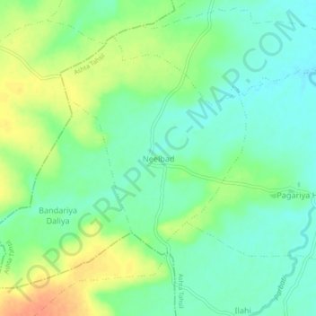
Name: Neelbad topographic map, elevation, terrain.
Location: Neelbad, Ashta Tahsil, Sehore District, Madhya Pradesh, India (22.87817 76.61469 22.91817 76.65469)
Average elevation: 1,709 ft
Minimum elevation: 1,657 ft
Maximum elevation: 1,788 ft
Thank you for supporting this site ❤️
Make a donation
Make a donation
Gear up for your next adventure:
As an Amazon Associate, this site earns from qualifying purchases at no extra cost to you.