
Make a donation
Gear up for your next adventure:
As an Amazon Associate, this site earns from qualifying purchases at no extra cost to you.
Rückersbach topographic map
Click on the map to display elevation.
Make a donation
Gear up for your next adventure:
As an Amazon Associate, this site earns from qualifying purchases at no extra cost to you.
Rückersbach
Rückersbach liegt an der Kreisstraße AB 13 nordwestlich von Oberafferbach. Im Norden verläuft die Staatsstraße 2443 zwischen Hohl und Hörstein. Der topographisch höchste Punkt der Dorfgemarkung befindet sich am Berggipfel des Haags nördlich des Ortes mit 403 m ü. NN, der niedrigste liegt am Elmertsbach auf 216 m ü. NN. Oberhalb von Rückersbach verläuft der Fränkische Marienweg.
Make a donation
Gear up for your next adventure:
As an Amazon Associate, this site earns from qualifying purchases at no extra cost to you.
About this map
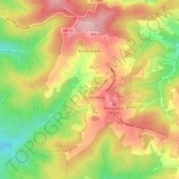
Name: Rückersbach topographic map, elevation, terrain.
Average elevation: 1,033 ft
Minimum elevation: 673 ft
Maximum elevation: 1,322 ft
Make a donation
Gear up for your next adventure:
As an Amazon Associate, this site earns from qualifying purchases at no extra cost to you.