
Thank you for supporting this site ❤️
Make a donation
Make a donation
Gear up for your next adventure:
As an Amazon Associate, this site earns from qualifying purchases at no extra cost to you.
Franja de Gaza topographic map
Click on the map to display elevation.
Thank you for supporting this site ❤️
Make a donation
Make a donation
Gear up for your next adventure:
As an Amazon Associate, this site earns from qualifying purchases at no extra cost to you.
About this map
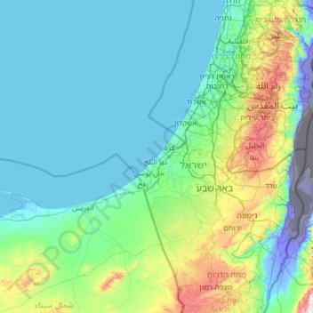
Name: Franja de Gaza topographic map, elevation, terrain.
Location: Franja de Gaza, Az-Zawayda, Territorios Palestinos (30.44322 33.36001 32.44322 35.36001)
Average elevation: 482 ft
Minimum elevation: -1,362 ft
Maximum elevation: 5,217 ft
Thank you for supporting this site ❤️
Make a donation
Make a donation
Gear up for your next adventure:
As an Amazon Associate, this site earns from qualifying purchases at no extra cost to you.