Geolocate

Prophetstown topographic map

Click on the map to display elevation.

About this map

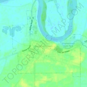
Name: Prophetstown topographic map, elevation, terrain.

Location: Prophetstown, Whiteside County, Illinois, United States (41.66172 -89.94948 41.68271 -89.91287)

Average elevation: 614 ft

Minimum elevation: 591 ft

Maximum elevation: 646 ft

Whiteside County trails, hiking, mountain biking, running and outdoor activities

Gear up for your next adventure:

💧Water Filtration Bottles - Safely drink from streams and lakes while exploring
🧭Hiking Compass - Precision compass for reliable navigation in the wilderness
🩹Survival Bandages - High‑quality bandages for emergencies
🔋Solar Power Banks - Keep your GPS and phone charged in remote wilderness areas
📚USA Hiking Guide Books - Top trail guides and map books

As an Amazon Associate, this site earns from qualifying purchases at no extra cost to you.