
Thank you for supporting this site ❤️
Make a donation
Make a donation
Gear up for your next adventure:
As an Amazon Associate, this site earns from qualifying purchases at no extra cost to you.
Guerrero topographic map
Click on the map to display elevation.
Thank you for supporting this site ❤️
Make a donation
Make a donation
Gear up for your next adventure:
As an Amazon Associate, this site earns from qualifying purchases at no extra cost to you.
About this map
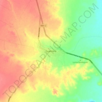
Name: Guerrero topographic map, elevation, terrain.
Location: Guerrero, Municipio de Guerrero, Coahuila, Mexico (28.26933 -100.42056 28.34933 -100.34056)
Average elevation: 745 ft
Minimum elevation: 633 ft
Maximum elevation: 830 ft
Thank you for supporting this site ❤️
Make a donation
Make a donation
Gear up for your next adventure:
As an Amazon Associate, this site earns from qualifying purchases at no extra cost to you.