Geolocate

Hay topographic map

Click on the map to display elevation.

About this map

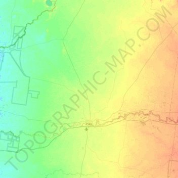
Name: Hay topographic map, elevation, terrain.

Location: Hay, Hay Shire Council, New South Wales, 2711, Australia (-34.56352 144.43196 -34.19313 145.24469)

Average elevation: 295 ft

Minimum elevation: 259 ft

Maximum elevation: 348 ft

Gear up for your next adventure:

🔦Powerful Headlamps - Ultra-bright hands-free lighting for night navigation
🎒Day Hiking Backpack - Lightweight backpack perfect for day trips and outdoor adventures
🎒Hydration Pack - Hands‑free water reservoir for long hikes
🥤Water Filter Bottle - All‑in‑one filter bottle for safe hydration
😴Insulated Sleeping Pads - Compact and warm pads for high-elevation camping

As an Amazon Associate, this site earns from qualifying purchases at no extra cost to you.