
منطقه ۲ topographic map
Interactive map
Click on the map to display elevation.
About this map
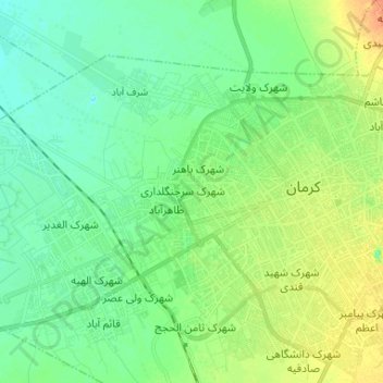
Name: منطقه ۲ topographic map, elevation, terrain.
Average elevation: 5,758 ft
Minimum elevation: 5,722 ft
Maximum elevation: 5,827 ft
Other topographic maps
Click on a map to view its topography, its elevation and its terrain.
Kerman
Iran > Kerman Province > Kerman County > Kerman
Kerman, بخش مرکزی شهرستان کرمان, Kerman County, Kerman Province, 7617797744, Iran
Average elevation: 5,974 ft