Geolocate

Kerman topographic maps

Click on a map to view its topography, its elevation and its terrain.
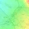
منطقه ۲

Iran > Kerman Province > Kerman County > Kerman

Average elevation: 5,758 ft

Gear up for your next adventure:

🛰️Handheld GPS Units - Professional satellite navigators for precise backcountry mapping
🛰️Satellite Messengers - Emergency SOS and two-way messaging for off-grid adventures
🛡️Insect Repellent - Protection against bugs during outdoor activities
🌡️Handheld Weather Meters - Measure wind, temp, and pressure for safe mountain travel
🔭Compact Binoculars - HD vision for scouting terrain and identifying distant landmarks

As an Amazon Associate, this site earns from qualifying purchases at no extra cost to you.