
Thank you for supporting this site ❤️
Make a donation
Make a donation
Gear up for your next adventure:
As an Amazon Associate, this site earns from qualifying purchases at no extra cost to you.
Tolantongo topographic map
Click on the map to display elevation.
Thank you for supporting this site ❤️
Make a donation
Make a donation
Gear up for your next adventure:
As an Amazon Associate, this site earns from qualifying purchases at no extra cost to you.
About this map
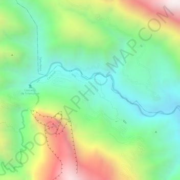
Name: Tolantongo topographic map, elevation, terrain.
Location: Tolantongo, Cardonal, Hidalgo, Mexico (20.64261 -99.00821 20.65532 -98.98532)
Average elevation: 5,013 ft
Minimum elevation: 3,829 ft
Maximum elevation: 6,913 ft
Thank you for supporting this site ❤️
Make a donation
Make a donation
Gear up for your next adventure:
As an Amazon Associate, this site earns from qualifying purchases at no extra cost to you.