
Make a donation
Gear up for your next adventure:
As an Amazon Associate, this site earns from qualifying purchases at no extra cost to you.
Specie Mesa topographic map
Click on the map to display elevation.
Make a donation
Gear up for your next adventure:
As an Amazon Associate, this site earns from qualifying purchases at no extra cost to you.
About this map
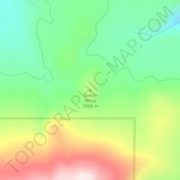
Name: Specie Mesa topographic map, elevation, terrain.
Location: Specie Mesa, San Miguel County, Colorado, United States (37.95633 -108.07512 37.95643 -108.07502)
Average elevation: 9,623 ft
Minimum elevation: 8,970 ft
Maximum elevation: 10,630 ft
San Miguel County trails, hiking, mountain biking, running and outdoor activities
Make a donation
Gear up for your next adventure:
As an Amazon Associate, this site earns from qualifying purchases at no extra cost to you.
Other topographic maps
Click on a map to view its topography, its elevation and its terrain.
Telluride Ski Area
United States > Colorado > San Miguel County > Mountain Village
Average elevation: 10,551 ft