
Crosbyton topographic map
Interactive map
Click on the map to display elevation.
About this map
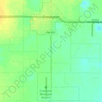
Name: Crosbyton topographic map, elevation, terrain.
Location: Crosbyton, Crosby County, Texas, United States (33.61591 -101.25106 33.66867 -101.22049)
Average elevation: 3,015 ft
Minimum elevation: 2,986 ft
Maximum elevation: 3,054 ft
Other topographic maps
Click on a map to view its topography, its elevation and its terrain.
Estacado
United States > Texas > Crosby County
Estacado, Crosby County, Texas, United States
Average elevation: 3,202 ft
Lorenzo
United States > Texas > Crosby County
Lorenzo, Crosby County, Texas, United States
Average elevation: 3,169 ft
Ralls
United States > Texas > Crosby County
Ralls, Crosby County, Texas, 79357, United States
Average elevation: 3,110 ft