Geolocate

Cagraray topographic map

Click on the map to display elevation.

About this map

Name: Cagraray topographic map, elevation, terrain.

Location: Cagraray, Bacacay, Albay, Bicol Region, Philippines (13.27826 123.86775 13.31826 123.90775)

Average elevation: 220 ft

Minimum elevation: -16 ft

Maximum elevation: 1,217 ft

Other topographic maps

Click on a map to view its topography, its elevation and its terrain.
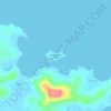
Pinamuntugan Island

Philippines > Albay > Bacacay > Busdac

Average elevation: 26 ft

Sula Island

Philippines > Albay > Bacacay > Nahapunan

Average elevation: 43 ft

Pinamuntugan Island

Philippines > Albay > Bacacay > Busdac

Average elevation: 26 ft

Gear up for your next adventure:

🚁Photography Drones - Capture stunning aerial views of landforms and topography
🪶Trail Camera - Capture wildlife on your hikes
🧭Compass with Lanyard - Easy‑carry compass for navigation
🛡️Insect Repellent - Protection against bugs during outdoor activities
🗃️Trail First Aid Kit - Essential kit for outdoor injuries and emergencies

As an Amazon Associate, this site earns from qualifying purchases at no extra cost to you.