
Make a donation
Gear up for your next adventure:
As an Amazon Associate, this site earns from qualifying purchases at no extra cost to you.
Sint-Jacobskapelle topographic map
Click on the map to display elevation.
Make a donation
Gear up for your next adventure:
As an Amazon Associate, this site earns from qualifying purchases at no extra cost to you.
Sint-Jacobskapelle
Sint-Jacobs-Kapelle is gelegen in de West-Vlaamse Middellandpolders op een hoogte van ongeveer 2,5 meter. Ten oosten van de dorpskom stroomt de IJzer.
Make a donation
Gear up for your next adventure:
As an Amazon Associate, this site earns from qualifying purchases at no extra cost to you.
About this map
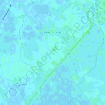
Name: Sint-Jacobskapelle topographic map, elevation, terrain.
Location: Sint-Jacobskapelle, Diksmuide, West-Vlaanderen, België (50.99711 2.81748 51.02402 2.85172)
Average elevation: 3 ft
Minimum elevation: -7 ft
Maximum elevation: 16 ft
Make a donation
Gear up for your next adventure:
As an Amazon Associate, this site earns from qualifying purchases at no extra cost to you.
Other topographic maps
Click on a map to view its topography, its elevation and its terrain.