

Prešov topographic map
Click on the map to display elevation.
Prešov
The municipality lies at an altitude of 296 metres (971 ft) and covers an area of 71.09 km2 (27.45 sq mi) (2025). It is located in north-eastern Slovakia, at the northern reaches of the Košice Basin, at the confluence of the Torysa river with its tributary Sekčov. Mountain ranges nearby include Slanské vrchy (south-east), Šarišská vrchovina (south-west), Bachureň (west), and Čergov (north). The neighbouring city of Košice is 34 km (21 mi) to the south. Prešov is about 50 km (31 mi) south of the Polish border, 60 km (37 mi) north of the Hungarian border and is some 410 km (250 mi) northeast of Bratislava (by road).
About this map
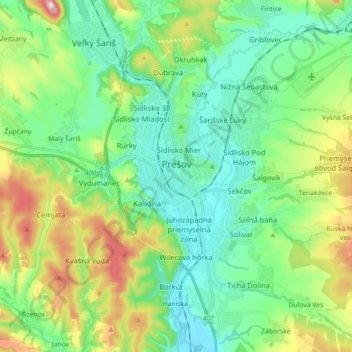
Name: Prešov topographic map, elevation, terrain.
Location: Prešov, District of Prešov, Region of Prešov, Slovakia (48.94500 21.15699 49.04684 21.33543)
Average elevation: 1,060 ft
Minimum elevation: 741 ft
Maximum elevation: 1,854 ft