Geolocate

Fangataufa topographic map

Click on the map to display elevation.

About this map
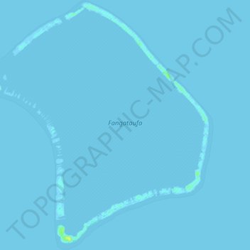
Name: Fangataufa topographic map, elevation, terrain.

Location: Fangataufa, Tureia, Tuamotu-Gambier, French Polynesia, 98784, France (-22.28376 -138.79274 -22.19446 -138.70150)

Average elevation: 0 ft

Minimum elevation: -3 ft

Maximum elevation: 52 ft

Other topographic maps

Click on a map to view its topography, its elevation and its terrain.

Moruroa

France > French Polynesia > Tureia

Average elevation: 0 ft

Tematangi

France > French Polynesia > Tureia

Average elevation: 0 ft

Tureia

France > French Polynesia > Tureia

Average elevation: 0 ft

Vanavana

France > French Polynesia > Tureia

Average elevation: 0 ft

Vanavana

France > French Polynesia > Tureia

Average elevation: 0 ft

Gear up for your next adventure:

👟Trail Running Shoes - Lightweight shoes for trail runners
🔦Powerful Headlamps - Ultra-bright hands-free lighting for night navigation
🪶Compact Camp Shovel - Folding shovel for campsite tasks
🔥Plasma Lighters - Windproof lighters that work in any weather condition
🌄Hiking Binoculars - Compact binoculars for scenic views and trail spotting

As an Amazon Associate, this site earns from qualifying purchases at no extra cost to you.