Geolocate

Bagneri topographic map

Click on the map to display elevation.

About this map
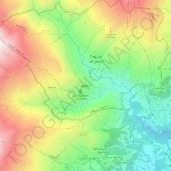
Name: Bagneri topographic map, elevation, terrain.

Location: Bagneri, Muzzano, Biella, Piemonte, 13817, Italia (45.55933 7.92965 45.59933 7.96965)

Average elevation: 3,314 ft

Minimum elevation: 1,670 ft

Maximum elevation: 5,390 ft

Gear up for your next adventure:

🚪Portable Camp Chair - Foldable chair for comfort at camp
🩳Quick‑Dry Hiking Shorts - Comfortable and quick‑dry shorts for summer hiking
🛰️Handheld GPS Units - Professional satellite navigators for precise backcountry mapping
🧭Map Reading Tools - Tools and kits for map navigation
⌚Solar GPS Watches - Advanced multisport watches with built-in topographic maps

As an Amazon Associate, this site earns from qualifying purchases at no extra cost to you.