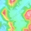
Nhive topographic map
Click on the map to display elevation.
About this map

Name: Nhive topographic map, elevation, terrain.
Location: Nhive, Malvan Taluka, Sindhudurg, Maharashtra, 416606, India (16.06132 73.46017 16.10132 73.50017)
Average elevation: 108 ft
Minimum elevation: -3 ft
Maximum elevation: 420 ft
Other topographic maps
Click on a map to view its topography, its elevation and its terrain.