
Fleming Island topographic map
Interactive map
Click on the map to display elevation.
About this map
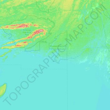
Name: Fleming Island topographic map, elevation, terrain.
Location: Fleming Island, Killarney, Sudbury District, Ontario, Canada (45.64850 -81.49673 46.28850 -80.85673)
Average elevation: 659 ft
Minimum elevation: 554 ft
Maximum elevation: 1,722 ft
Other topographic maps
Click on a map to view its topography, its elevation and its terrain.
Killarney Provincial Park
Killarney Provincial Park, Chikanishing Creek Road, Killarney, Sudbury District, Northeastern Ontario, Ontario, P0M 2A0, Canada
Average elevation: 607 ft
Silver Peak
Silver Peak, Killarney, Sudbury District, Northeastern Ontario, Ontario, Canada
Average elevation: 1,175 ft