Geolocate

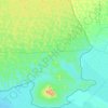
Diplo topographic map

Click on the map to display elevation.

About this map

Name: Diplo topographic map, elevation, terrain.

Location: Diplo, Diplo Taluka, Tharparkar District, Mirpur Khas Division, Sindh, 69280, Pakistan (24.45791 69.57151 24.47660 69.59309)

Average elevation: 79 ft

Minimum elevation: 10 ft

Maximum elevation: 210 ft

Other topographic maps

Click on a map to view its topography, its elevation and its terrain.

Satidera

Pakistan > Sindh > Tharparkar District

Average elevation: 351 ft

Naran jo Khario

Pakistan > Sindh > Tharparkar District > Mithi

Average elevation: 197 ft

Nagarparkar Taluka

Pakistan > Sindh > Tharparkar District

Average elevation: 167 ft

Tardos

Pakistan > Sindh > Tharparkar District

Average elevation: 397 ft

Gear up for your next adventure:

🚗GPS Dash Cams - Record your scenic drives through mountain passes and canyons
🎁Geography Themed Gifts - Unique gift ideas for map lovers and geography enthusiasts
🧯Emergency Survival Kit - All‑in‑one survival essentials for the backcountry
🧦Hiking Socks - Comfortable socks to prevent blisters on long hikes
🌡️Handheld Weather Meters - Measure wind, temp, and pressure for safe mountain travel

As an Amazon Associate, this site earns from qualifying purchases at no extra cost to you.