Geolocate

Santa Marinha topographic map

Click on the map to display elevation.

About this map
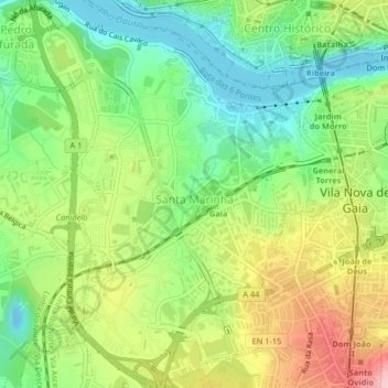
Name: Santa Marinha topographic map, elevation, terrain.

Location: Santa Marinha, Afurada, Vila Nova de Gaia, Porto, Portugal (41.11549 -8.63794 41.14548 -8.59703)

Average elevation: 253 ft

Minimum elevation: -33 ft

Maximum elevation: 620 ft

Other topographic maps

Click on a map to view its topography, its elevation and its terrain.

Lugar do Castelo

Portugal > Porto > Vila Nova de Gaia > Afurada

Average elevation: 243 ft

Gear up for your next adventure:

🔭Stargazing Telescopes - Perfect for camping in low-light pollution areas shown on maps
🍳Camping Cook Set - Complete cookware for outdoor meals
🔌USB Car Charger - Car charger for on‑the‑go power needs
🎒Trail Energy Bars - High‑calorie bars for hiking energy
🗺️NatGeo Topo Maps - High-quality waterproof printed topographic maps of US Parks

As an Amazon Associate, this site earns from qualifying purchases at no extra cost to you.